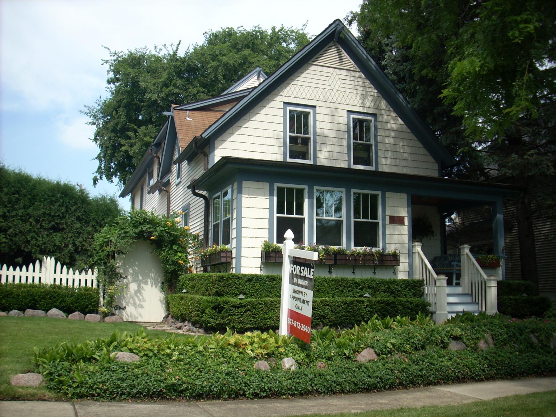
Building name:
Ground Floor Use: Residential
Upper Floor Use: Residential
Current Occupant: Residential
Zoning: R-7
Number of Stories: 2
Property Index Number: 1121203012
Within Local District?: No
Local Dist Contrib/Non-Contrib?: NC
Local Landmark?: No
Year: No
Local Landmark Eligible?: No
Criteria: No
NR District Contrib/Non-Contrib: NC
Within District?: No
NR Landmark?: No
Year: No
NR Eligible?: No
Criteria: No
Alternate Address?: No
Category: Building
Condition: Good
Integrity: Major alterations and additions
Current Use: Domestic - single dwelling
Historic Use: Domestic - single dwelling
Secondary Structure: Detached garage
NR Second: C
Architectural Classification: Gable Front
Details: Craftsman
Other Year: 1920 (c); 1997
Date source: Assessor/Surveyor/permit
Wall Material (Current): Wood - shingles
Wall Material 2 (Current): Wood
Plan: Rectangular
No of Stories: 2
Roof Type: Front Gable
Roof Material: Asphalt - shingle
Foundation: Not visible
Porch: Front entry
Window Material: Wood
Window Material 2: Wood
Window Type: Combination
Window Configuration: Combination
Significance: Combination
Historic Features: Front gable roof; hipped roof full-front porch structure (partially enclosed c. 1920); historic (but not original) 3/1 double hung windows on front facade
Alterations: Large 2-story rear addition that is taller than original house (1997); wood shingles on front facade (1951); front porch partially enclosed c. 1920; entry porch steps and railing are more recent
Old Address (city dir.year: Large 2-story rear addition that is taller than original house (1997); wood shingles on front facade (1951); front porch partially enclosed c. 1920; entry porch steps and railing are more recent
Building Moved?: Large 2-story rear addition that is taller than original house (1997); wood shingles on front facade (1951); front porch partially enclosed c. 1920; entry porch steps and railing are more recent
Moved From: Large 2-story rear addition that is taller than original house (1997); wood shingles on front facade (1951); front porch partially enclosed c. 1920; entry porch steps and railing are more recent
Original Owner: Whitney, Lew
Original Architect: Whitney, Lew
Architect Source: Whitney, Lew
Builder: Whitney, Lew
Surveyor: LR
Surveyor Organization: Ramsey Historic Consultants
Survey Date: May-June 2016
Survey Area: Downtown Libertyville
Old Address: Downtown Libertyville
Date of Construction: Downtown Libertyville
Moving Permit #: Downtown Libertyville
Date Moved: Downtown Libertyville
Building Permit #: Downtown Libertyville
Date: Downtown Libertyville
Building Permit Description: Downtown Libertyville
Cost: Downtown Libertyville
Original Owner Occupied?: Downtown Libertyville
Exterior Alteration Permits: 97-524 (7/11/1997)--rear addition ($50,000); No Permit # (11/2/1951)--reside house with John manvills Shingles
Other Permit Information: 00-974 (2001)--addition to garage
COA Info: 00-974 (2001)--addition to garage
Historic Info: Historic image of photograph on Illinois Digital Archives (in collection of Libertyville Mundelein Historical Society and Cook Memorial Public Library: http://www.idaillinois.org/cdm/singleitem/collection/cookmemo11/id/6501/rec/5 Back of photograph reads "House of Lew Whitney." According to Illinois Digital Archives, Whitney was a tinner.
Other Sources: Sanborn maps, 1933, 1948
Historic Info Compiler: LR
Volunteer: LR
 Contributing
 Non-contributing
.jpg)
.jpg)
